
New Field Google Map in a Grid Application
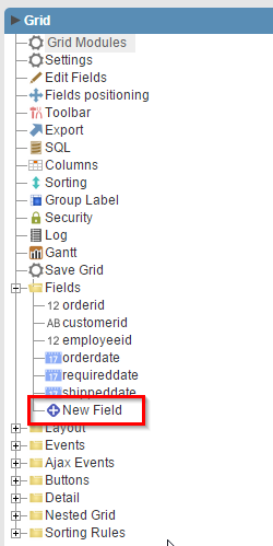
1. To display the Google Maps in a Grid Application, first we will create a new field on the Grid.
![]()
![]()
![]()
![]()
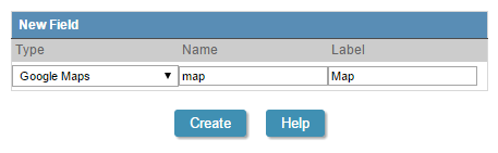
2. Select Google Maps type.
![]()
![]()
![]()
![]()
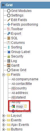
3. Then we must edit the field settings.
![]()
![]()
![]()
![]()
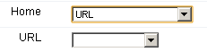
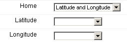
4. We have 3 ways to use a Google Maps field: Geocode, Latitude and Longitude and URL.
|
|
|
|||||||||||||||||||||||||||
|
|
|
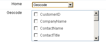
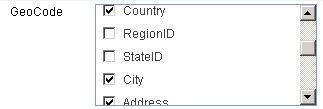
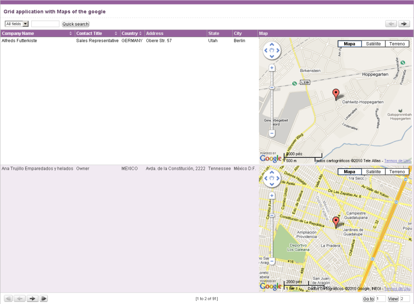
5. In this example we will use Geocode and select Country, City and Address fields to get the location.
![]()
![]()
![]()
![]()
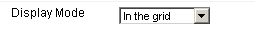
6. Select to display it on the Grid.
![]()
![]()
![]()
![]()
7. Then place your API Key on the field
![]()
![]()

![]()
![]()
Note: API Key is a unique key composed of a string (text) alphanumeric, which is nothing more than a license to use this service. When you sign up to use the service, the key is joined to a domain and a directory on the server. All pages that use the API must be under the directory that was used to register.
If you have a web server on your machine, you just get a key for local tests, and that's just put http://localhost in the domain field during the registration.
To get your API Key just enter the site: http://code.google.com/intl/en/apis/maps/signup.html
![]()
![]()
![]()
![]()
![]()